Weather Underground Radar. - For the Sterling and metropolitan area. Composite and Reflectivity are available with the use of filter controls.
Weather Underground. - US temperature chart 6 hour loop. Chart updated 4 times daily Click on your state for local weather station information.
Unisys Weather. - These images are generated by geostationary satellites orbitting 22,000 miles above the equator looking at the United States. These images updated once an hour at about 30 after the hour.
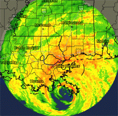
National Hurricane Center. - Super storm Sandy is no more and is one for the record books. Hurricane season ends November 30th.
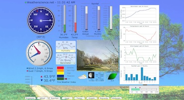
Weatherscience.net Cam - *new* Live feed
from our Roof Cam located at our Weatherscience.net studio. Click on the image to see a loop over the past 24 hours. Click here. to see a live feed.
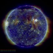
SpaceWeather.com. - A great place to find out about space weather and its effects on our planet. Get up to date information on auroras, solar flares, and meteor showers. Click here to get the latest SDO images or here for data from SolarSoft
LightningFinder.com Real time lightning data updated every 30 seconds. Downlaod the app for iPhone and Ipad.
About Earth's Weather. - Take a look in to the forces that affects and makes up earth's weather. Special thanks to Lisa Gardiner.
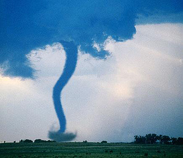
Tornado Chasers. - Weather related news pertaining to tornados as well as safety information on how to prepare for one in case one strikes in your area.
Eumetcast of Metop-2 is provided by Eumetsat and is updated every 3 minutes. To access EPS flight IR 10.8 clickhere.
NOAA Weather Radio. - Broadcast live over the web. Catch weather warnings and severe weather alerts.
Operations information and Special Events
Office of Satellite Operations Daily Satellite Status Report - On 11/25/2014 The truck delivering NOAA's Deep Space Climate Observatory spacecraft, or DSCOVR, enclosed in a protective shipping container, backs up to the door of the airlock of Building 2 at the Astrotech payload processing facility in Titusville, Florida, near Kennedy Space Center.
Read More..
Real Time Satellite Tracking - NOAA and other satelltes. Custom groups of satellites can be configured and tracked. Go to the main page to setup your location. Update 11/25/14: NOAA NPP has now been added.
Ecuadorian Civilian Space Agency - UPDATE 03/21/2013: EXA's NEE-01 PEGASUS is set to launch in 39 days. The NEE-01 PEGASUS is a nano satellite, of the cubesat 1U class, it has a cubic shape and two solar panel wings with 3 panels on each side for a total of 6 panels per wing, its dimensions are 10 by 10 by 75 centimeters. it has an on-board dual visible and infrared camera which will allow the spacecraft to take pictures and transmit live video from space.
NASA Website - Update 11/25/14 Two donuts of seething radiation that surround Earth, called the Van Allen radiation belts, have been found to contain a nearly impenetrable barrier that prevents the fastest, most energetic electrons from reaching Earth.The Van Allen belts are a collection of charged particles, gathered in place by Earth’s magnetic field. Read More..
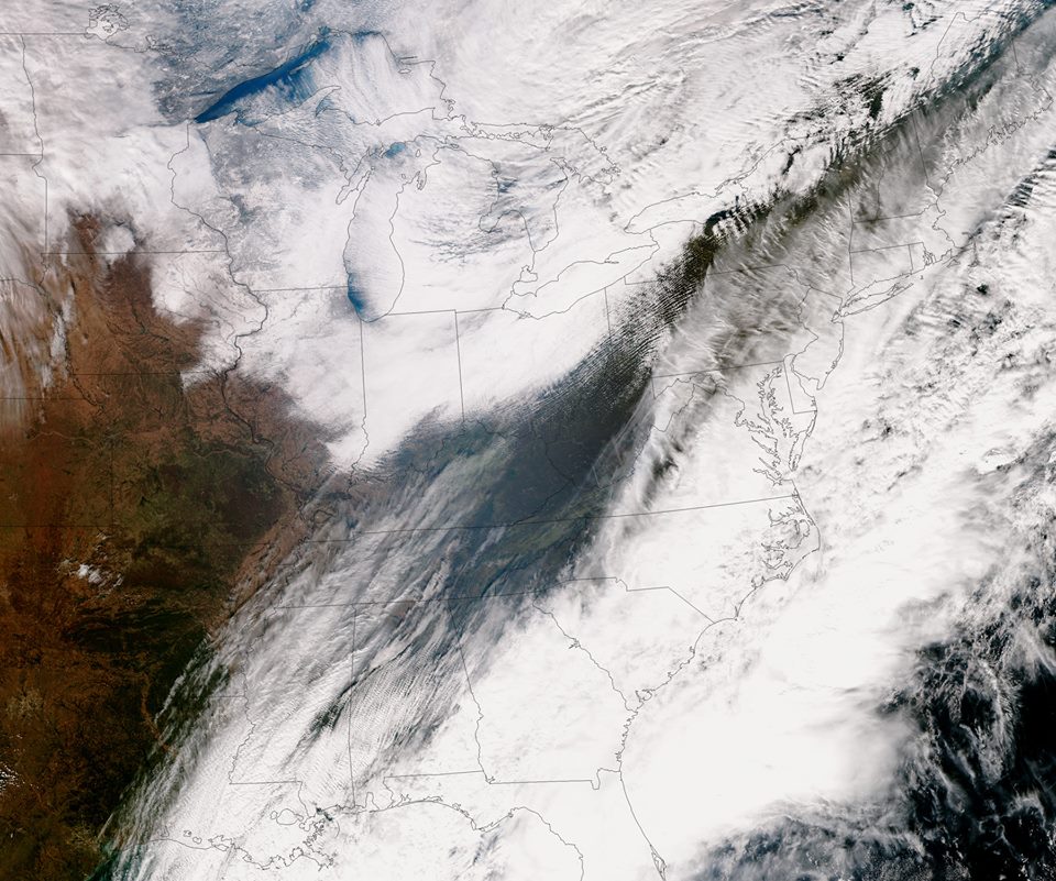
Photo of the Week - 11/25/14 An active East Coast weather pattern continues. A developing nor'easter is projected to cause havoc from the Carolinas to New England. The NOAA U.S. National Weather Service forecasts widespread precipitation from Florida to Maine. Image: SNPP VIIRS true-color image of the United States East Coast the evening of November 25, 2014. Credit: NOAA/NASA.
if you have a great weather or nature photo please email it to Webmaster@weatherscience.net and we will showcase it on our site.


